
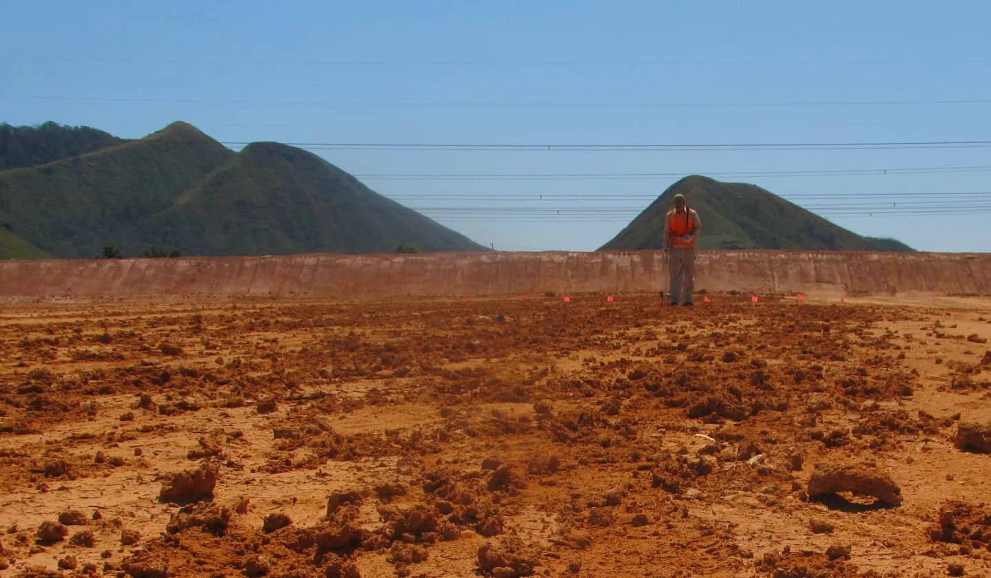


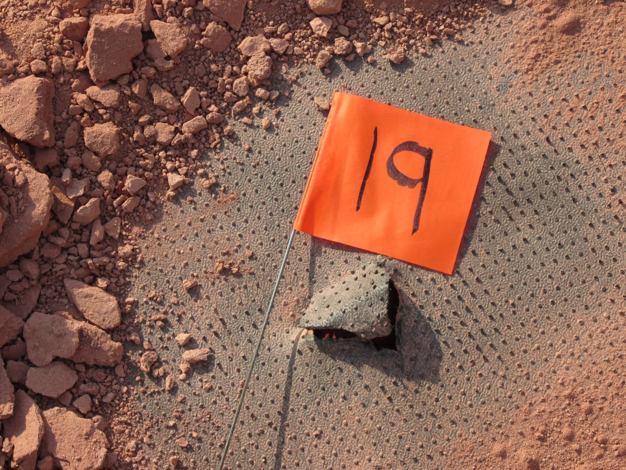
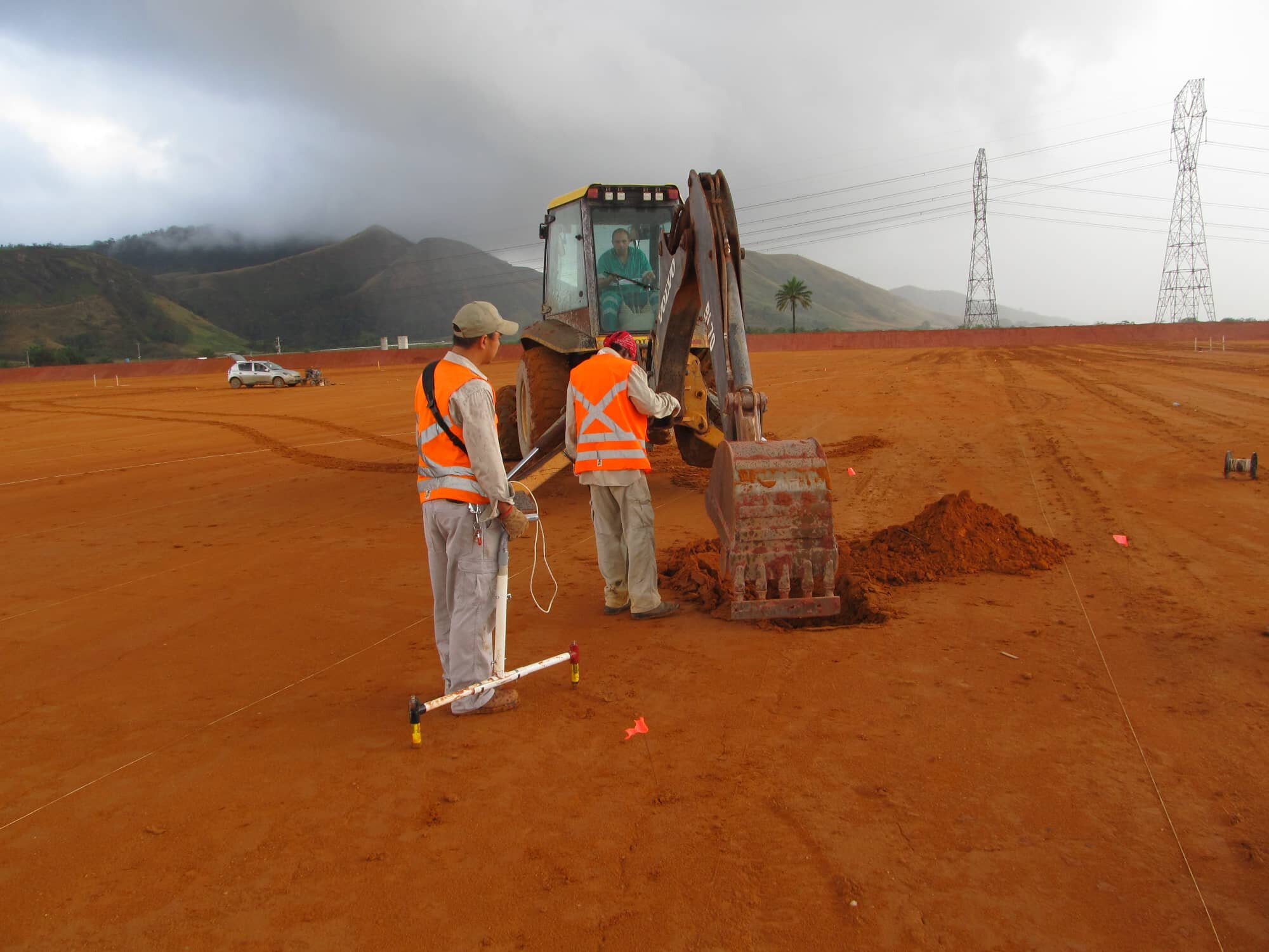
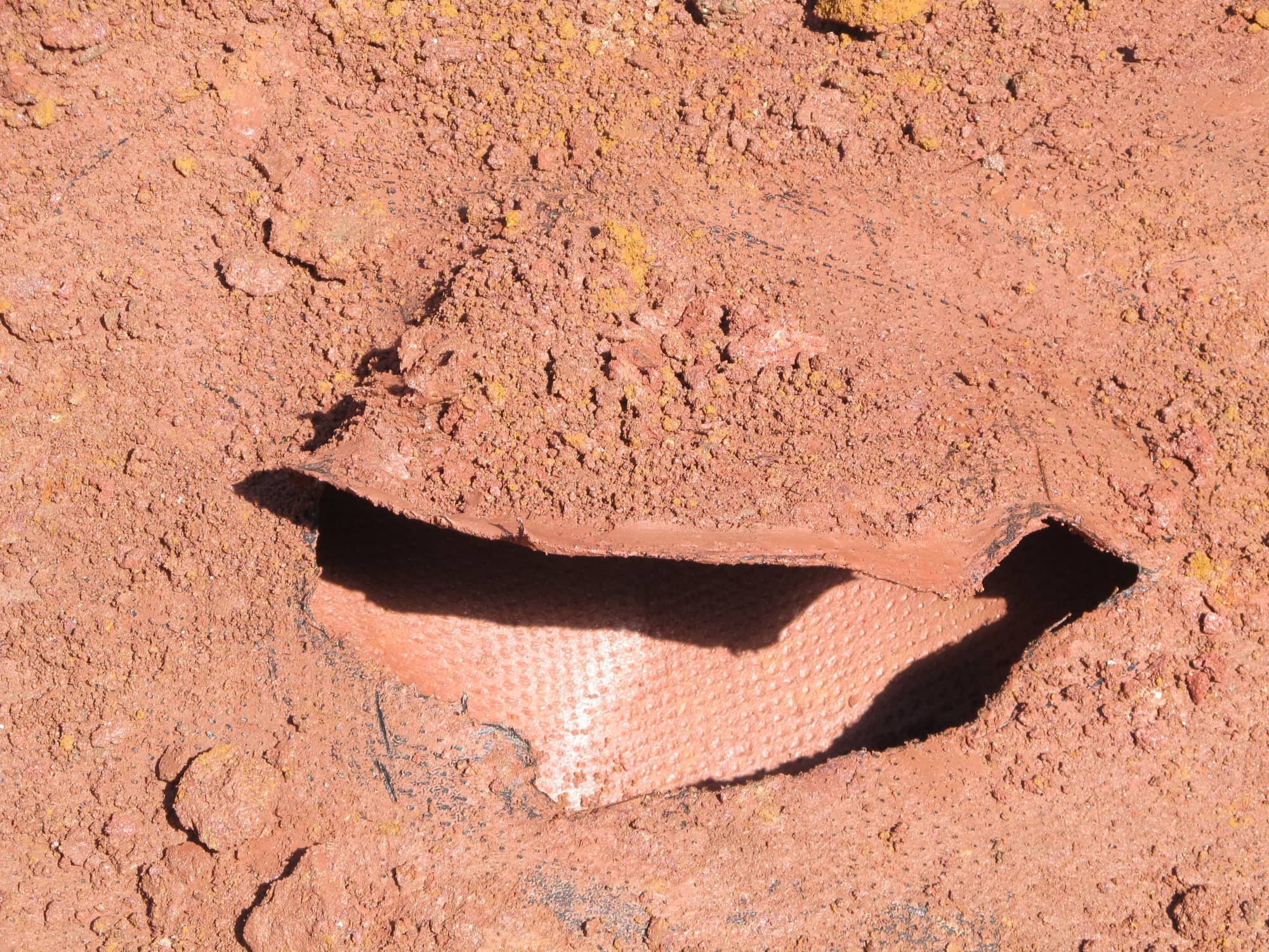
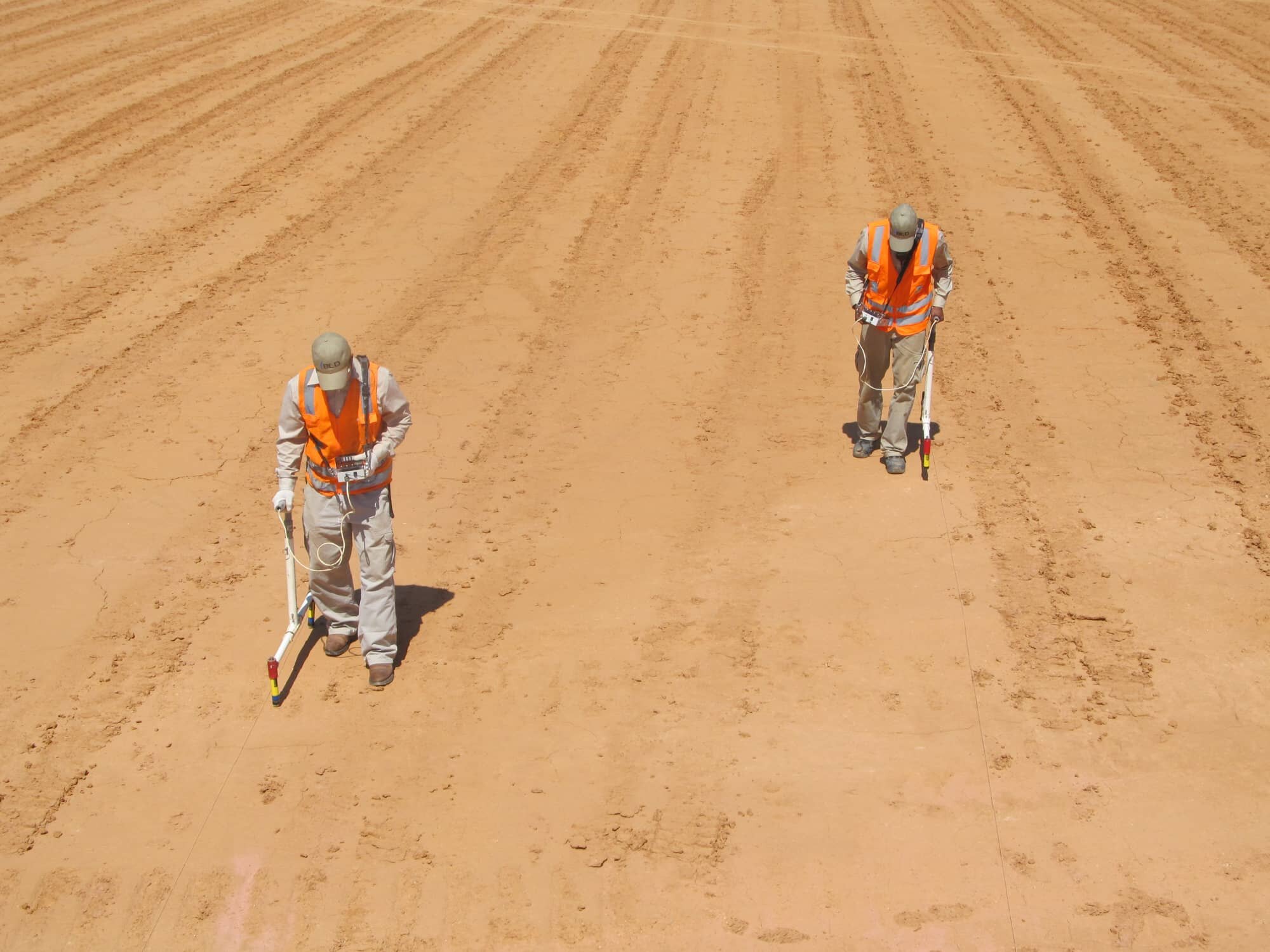
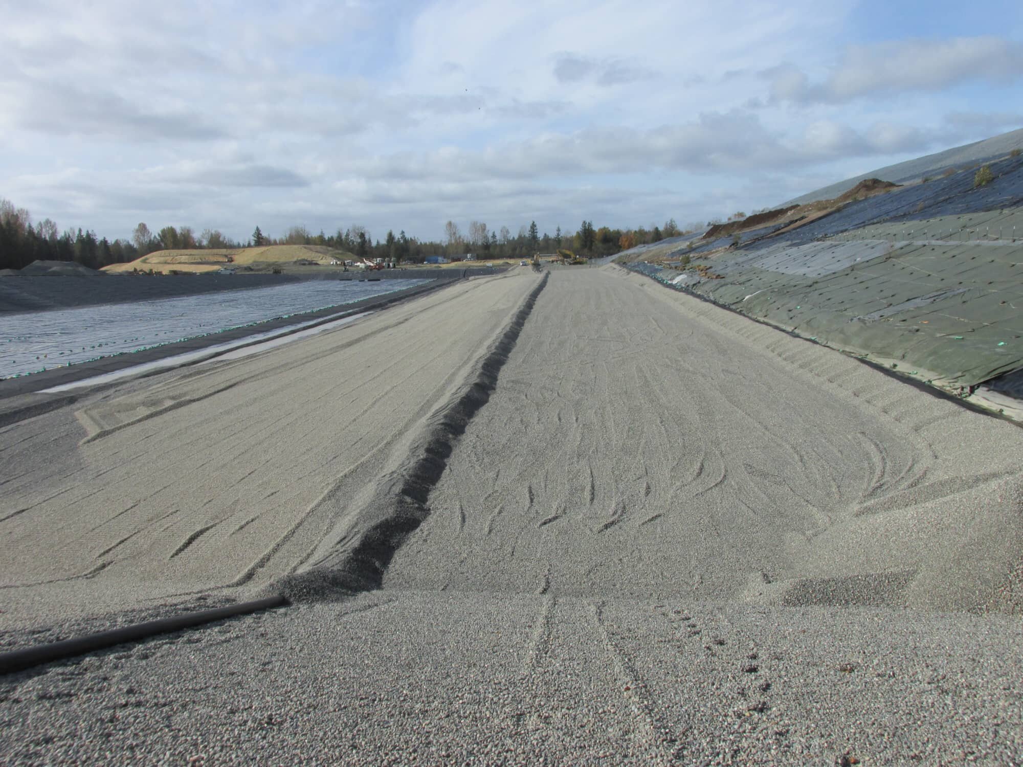
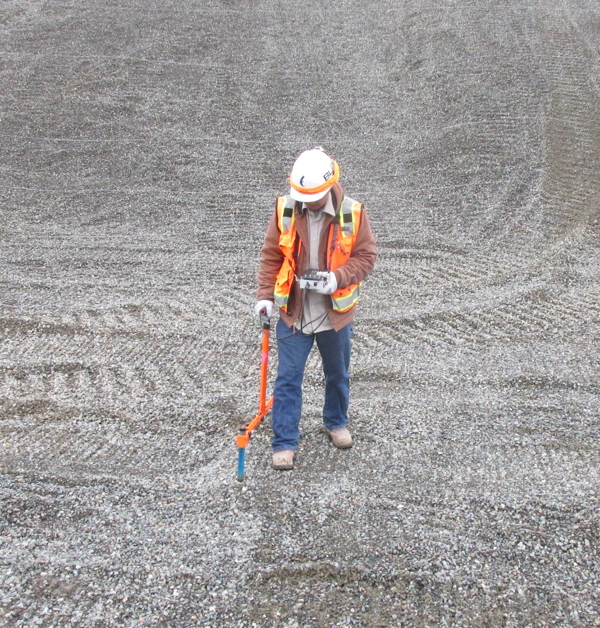
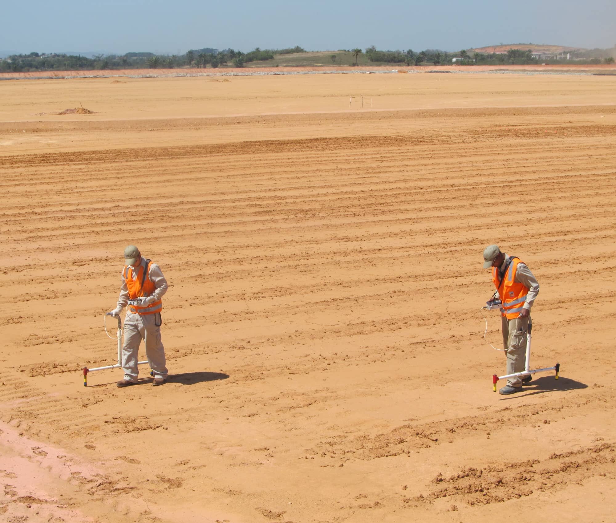
When earth materials cover the geomembrane, a soil survey can be performed to locate leaks. This is typically conducted on an operations layer prior to placement of waste or any layers that contain drainage material along with an underlying geomembrane. A coordinate system is created and placed throughout the entire survey area by using string lines (or paint lines) and flag lines. After completion of the grid system, potential measurements, or data, are collected via a soil probe and a portable, data acquisition system (polycorder). The collected measurements are downloaded to a portable computer and analyzed on BLD’s custom leak detection software application called DataCAT13 (Data Collecting Analysis Tool 13). Once the leaks have been identified on the software (if any), the location is pinpointed and marked for further investigation. During the investigation process, excavation of the operations layer will be required to expose the leaks. The leak locations and descriptions are documented, and thereafter, the repair process can proceed.
NOTE: The term "Operations Layer" may consist of any layer of soil, drainage/filtration soil, earthen material, or sediment with an underlying geomembrane liner.
APPLICABLE ASTM STANDARDS
- ASTM D6747-15 - Selection of Techniques for Electrical Leak Location of Leaks in Geomembranes
- ASTM D7007-16 - Electrical Methods for Locating Leaks in Geomembranes Covered with Water or Earthen Materials


Click to view >

Featured Project

BEST IN SOIL SURVEYS
"Most Popular Survey Method"
"Most Leaks Located Per Area"
Service ID
D7007 - DPOL
Dipole
COVERAGE
DESCRIPTION
REQUIREMENTS
DOWNLOADS
Final graded floor areas and side slopes that contain an operations layer depth between 6 to 36 in (15 to 90 cm)
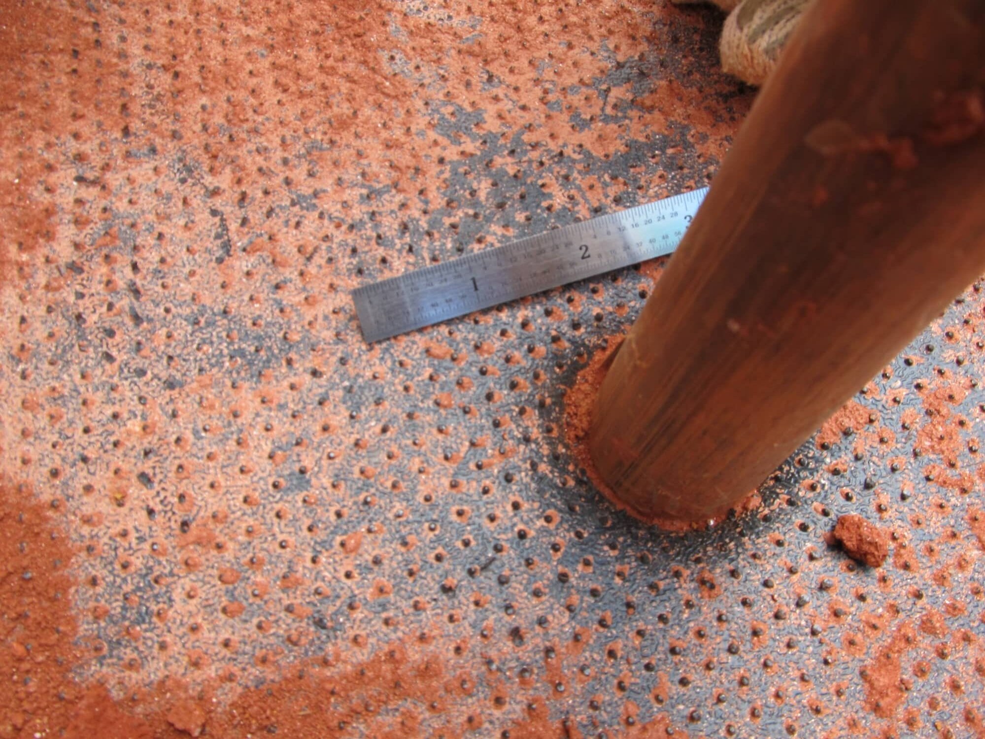
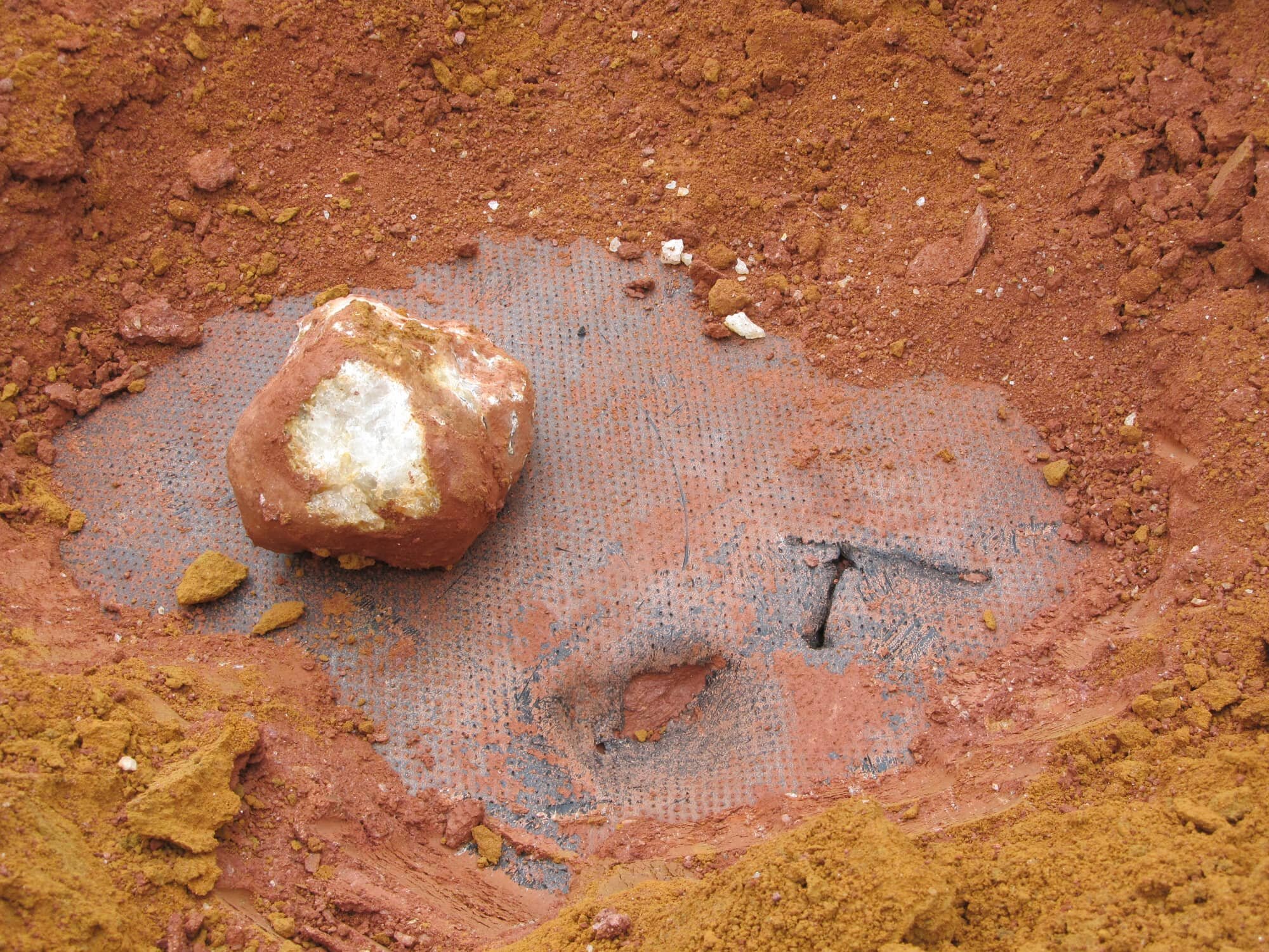
Being the most popular and common type of survey method when surveying on soil, the Dipole Method is typically known for it's accuracy in locating leaks in liners covered with earthen materials. This method is conducted by performing the survey on the surface of the operations layer throughout the entire survey area. A single-channel polycorder collects data at a constant speed rate. The soil dipole probe required for this survey method ranges from 3 to 5 ft (1 to 1.5 m) dipole spacings. The Dipole Method leads the pack for the number of leaks or penetrations located on soil-covered geomembranes.
direct contact with the operations layer
See our Preparations and Requirements Guide for General Contractors prior to an on-site leak detection service.

PREP Guide Single-Lined Systems

PREP Guide Double-Lined Systems
Click to view our Specifications Guide for the Electrical Leak Detection Quality Assurance Program using this method.

SPEC Guide Single-Lined Systems

SPEC Guide Double-Lined Systems

Service ID
D7007 - QPOL
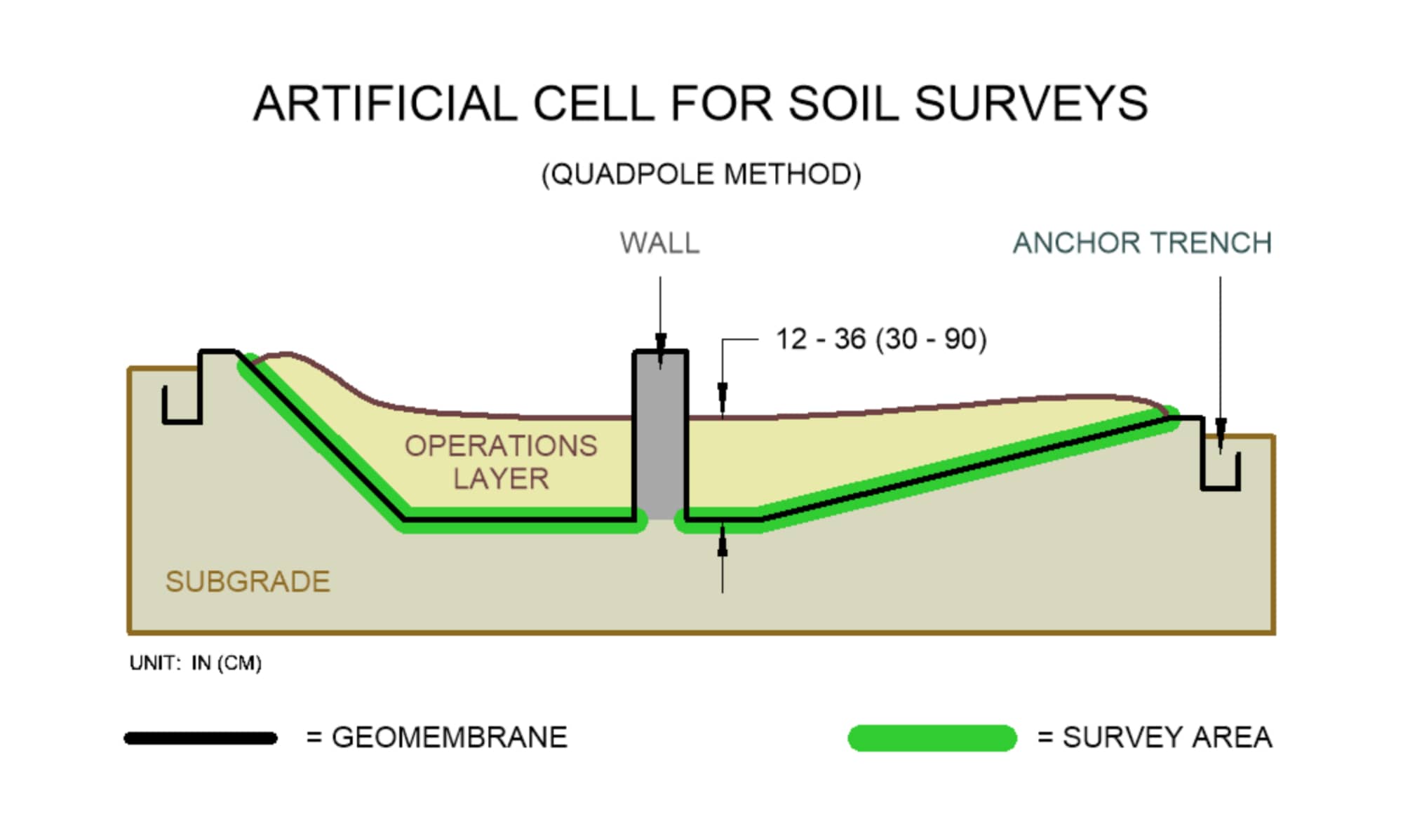
Quadpole
Coming soon. Please check back for service status.
COVERAGE
DESCRIPTION
REQUIREMENTS
DOWNLOADS
Final graded floor areas and side slopes that contain an operations layer depth between 6 to 36 in (15 to 90 cm)
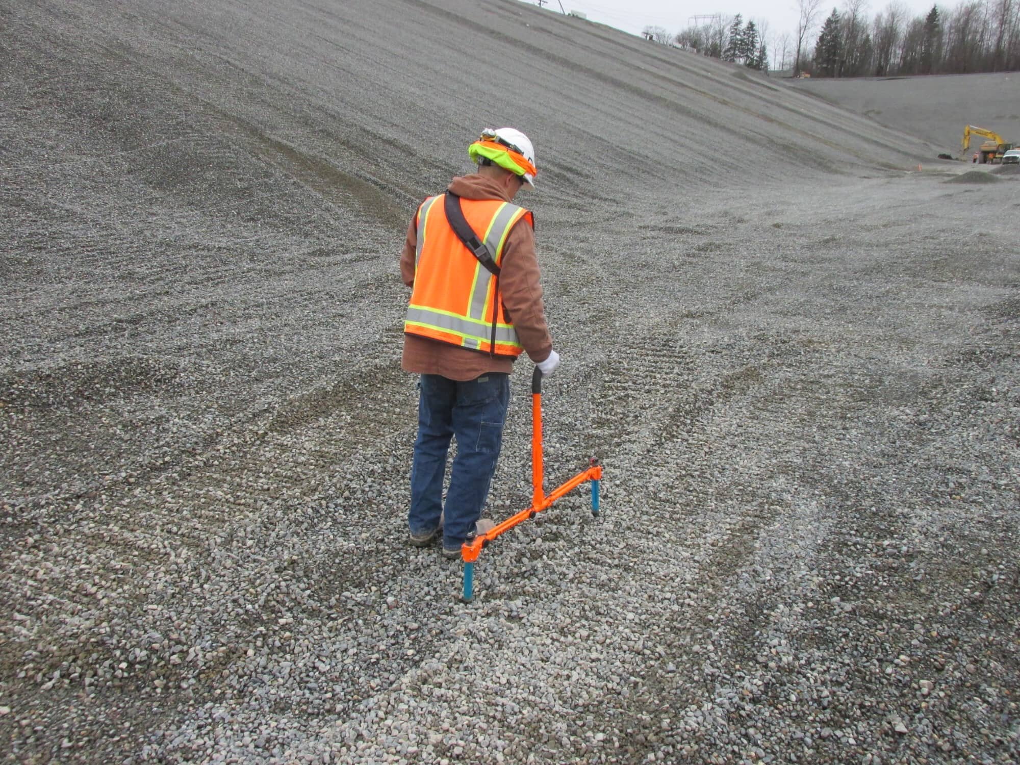
Similar to the Dipole Method, the Quadpole Method consists of two pairs of dipoles in one soil quadpole probe unit. Each measurement stored in the polycorder covers a 25 ft² (2.3 m²) area which speeds up the survey completion rate to be almost twice as fast! The probe is connected to a double-channel data acquisition system that records data while surveying. When it comes to survey area coverage, the Quadpole Method captures the flag for the most survey area tested per allotted time frame.
direct contact with the operations layer

Click to view >

BEST IN SOIL SURVEYS
"Fastest Survey Area Coverage"


Click to view >

BEST IN SOIL SURVEYS
"Ranks Highest In Leak Detection
Sensitivity"
Survey Method ID
D7007 - PPOL
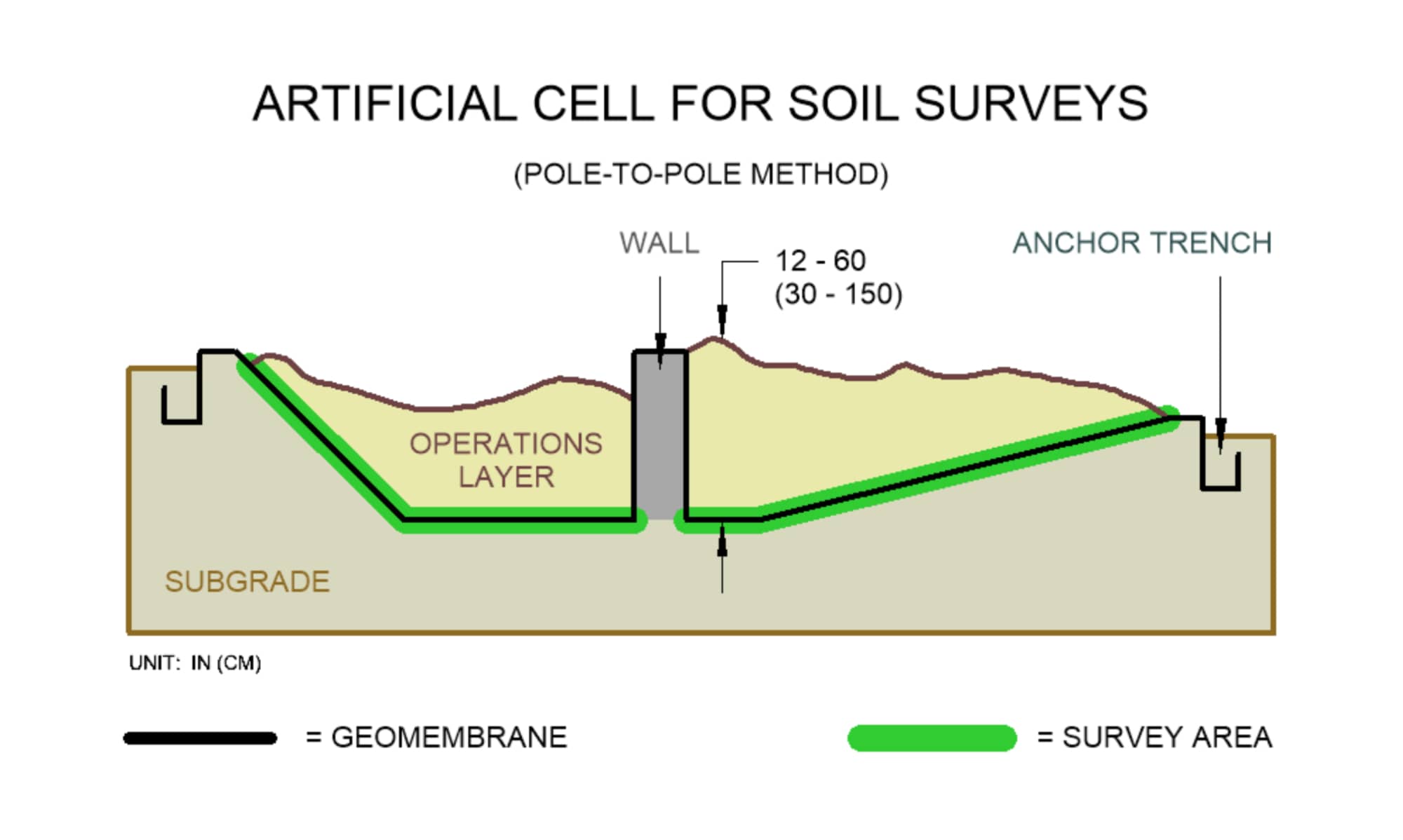
Pole - To - Pole
COVERAGE
DESCRIPTION
REQUIREMENTS
DOWNLOADS
Non-graded floor areas and side slopes that contain an operations layer depth between 6 to 60 in (15 to 150 cm)
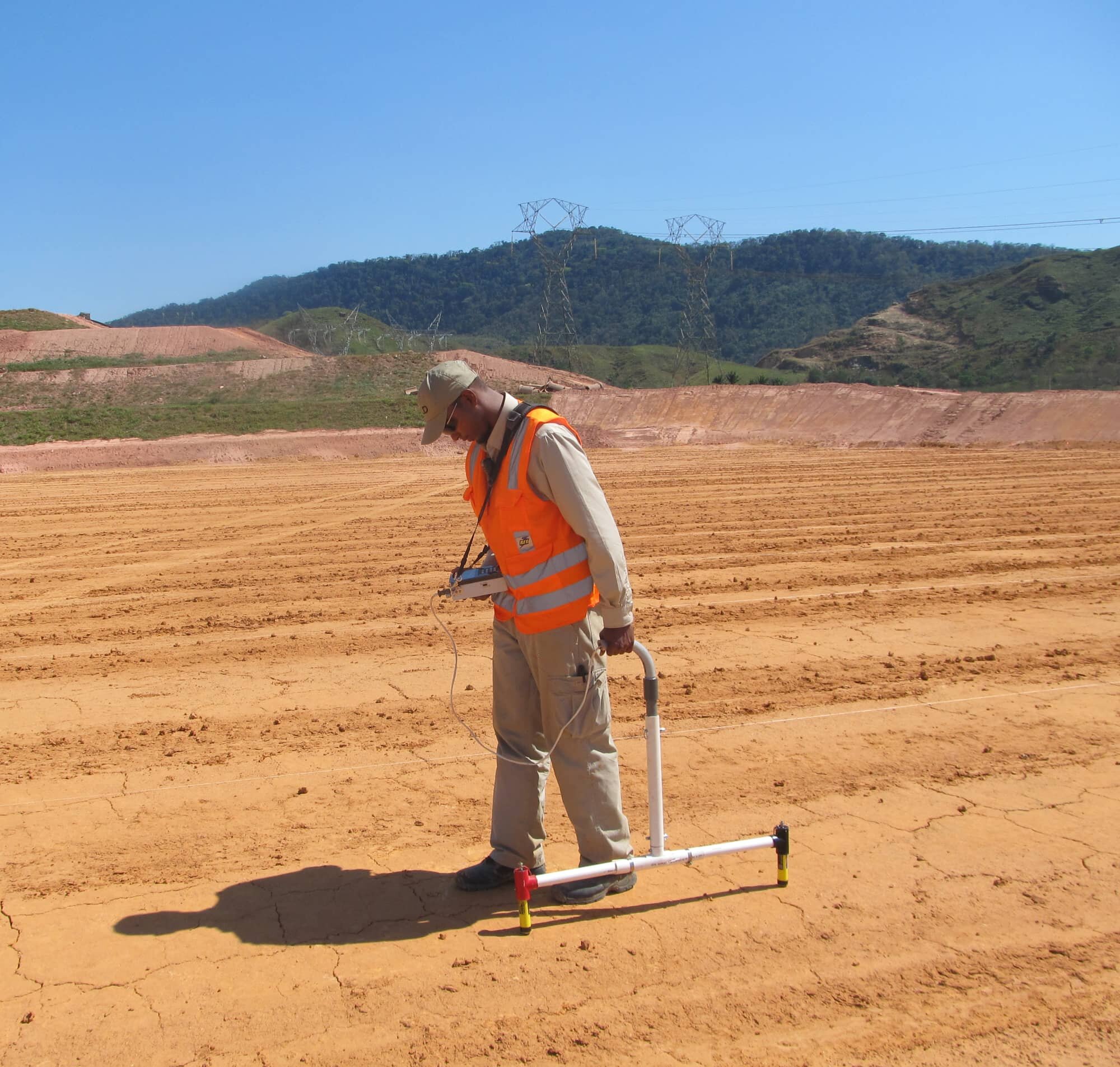
Having piles of non-graded soil surfaces should not prevent a survey from being performed. The integrity of a liner can still be checked even with a deep layer of soil. To perform the Pole-To-Pole Method, two single pole probes are spaced at different distances and measurements are collected. The probes are connected to a single-channel data acquisition system that records data while surveying. The Pole-To-Pole Method works perfect for irregular, non-graded piles of soil and is the most sensitive among all soil survey methods.
direct contact with the operations layer
Currently not available
* Recognitions are based on gathered information and data collected since 2010 when compared to other survey methods provided by BLD.
